
1h 44m
Estimated time
Est. time
2.2mi
Estimated length
Est. length
Mostly flat
Elevation
Elevation
Moderate
Hard
Good conditions
About the course
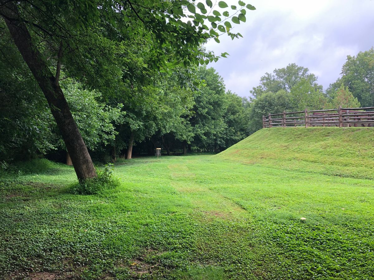
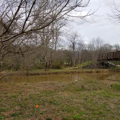
Nestled along the South Fork River in downtown Cramerton, Goat Island offers a fun and technical round for players of all skill levels. The course is mostly flat but heavily wooded, demanding accuracy and touch over pure power. Expect low-ceiling fairways and plenty of challenging lines to test your shot shaping.
Signature holes:
Hole 3 Long and Hole 18 Long feature water carries that add both beauty and risk. (For the record, the river’s about waist deep if you decide to retrieve a disc on 18!)
A bad tree kick can also bring water into play on a few other holes, so stay sharp.
Amenities:
Bathrooms and restaurants are conveniently located just across the bridge in downtown Cramerton, between the front and back 9.
Parking options:
Downtown side: Start on Hole 10 and naturally flow into the front 9.
Lakewood side: Start near the practice basket and kiosk, featuring local club information and events.
18 holes
Concrete, Asphalt, Brick/Pavers Tees
DISCatcher Pro (original) Targets
Mixed use
Public park
Dogs allowed
There is a dog park by Hole 1
Cart friendly
Mostly Flat
Drinking water available
Across the bridge between 9 & 10 by the bathrooms.
Restroom available
Across the bridge between 9 & 10 by the bathrooms.
Stroller friendly
Mostly Flat
Limited mobility/cane accessible
Mostly flat course
Established in 2013
Course designers
Time your trip
Course traffic - Players usually spend 1 - 2 hours here.
Want access to real-time course traffic?It's on UDisc Pro.
Location
See the maps
Time your trip
Course traffic - Players usually spend 1 - 2 hours here.
Want access to real-time course traffic?It's on UDisc Pro.
What's in the area
Follow course maps with the UDisc app
Scan with your mobile device
Reviews
Show allUpkeep
3.5
Shot variety/design
4.2
Tee areas
3.3
Signage/wayfinding
3.5
Amenities
3.1
Scenery/views
4.1

@yetimaster
53
This course has been improved tremendously in the past few years. Really fun, smaller, technical course. Water is "technically" in play on almost every hole but it's more so if you really pull a disc or have a very bad kick.
1
@nextian
14
Lots of fun. Almost lost a disc in the river

Upcoming events
Show allNearby courses
Nearby stores
Frequently asked questions
How do I get to Goat Island?
How do I get to Goat Island?
You can get directions to Goat Island by clicking Get Directions, which will open your device's map application with the disc golf course location. The disc golf course is located at 35.23944076621348, -81.06935676187277 in Belmont, North Carolina.
Do I need to pay to play disc golf at Goat Island?
Do I need to pay to play disc golf at Goat Island?
Goat Island is free to play! Just show up and enjoy the disc golf course.
What is the difficulty and length of Goat Island?
What is the difficulty and length of Goat Island?
Goat Island has 18 disc golf holes and has a difficulty rating of "Moderate" and "Hard". The typical disc golf round at Goat Island takes about 2 hours and covers approximately 2.2 miles (3.6 km).
How highly rated is Goat Island by the disc golf community?
How highly rated is Goat Island by the disc golf community?
Goat Island has an average rating of 3.9 out of 5 stars based on 869 community reviews. This is considered a good course rating by the disc golf community.
What amenities are available at Goat Island?
What amenities are available at Goat Island?
Goat Island offers the following amenities: 18 disc golf holes, restrooms, drinking water, cart-friendly paths, pet-friendly areas, stroller-friendly paths. Restroom details: Across the bridge between 9 & 10 by the bathrooms. Water availability: Across the bridge between 9 & 10 by the bathrooms. Cart information: Mostly Flat Pet policy: There is a dog park by Hole 1 Stroller access: Mostly Flat
When is the best time to play at Goat Island?
When is the best time to play at Goat Island?
Upgrade to UDisc Pro to see detailed course traffic patterns and find the best times to play disc golf here.
How can I record my disc golf round at Goat Island?
How can I record my disc golf round at Goat Island?
You can record your disc golf round using the UDisc mobile app. If on your phone, tap the "Start a Round" button at the bottom of this page to begin navigating Goat Island and recording your disc golf round. The app provides GPS-enabled disc golf hole maps, scorekeeping, and statistics. Upgrade to UDisc Pro for advanced features like detailed statistics and course traffic information.